There are popular posts on the Internet about supposedly sunken planes, which anyone can find in the Google Earth application. We have verified the accuracy of these publications.
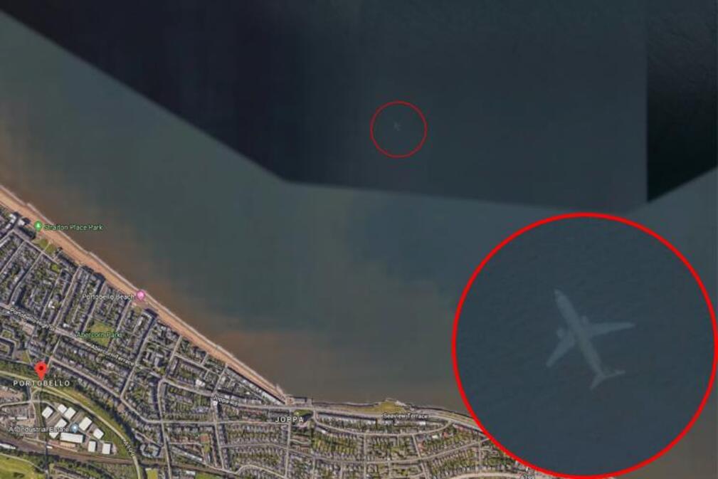
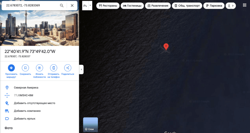
Information about a sunken plane captured by satellite near Scotland was published British newspaper The Mirror in 2018 - service user Robert Morton told the publication about his anomalous find. The news quickly gained popularity, and Russian publications wrote about it, for example, “Komsomolskaya Pravda" And Russia Today. In September 2022, on the popular site Reddit, a user discovered another “underwater” plane, only this time near the Bahamas. Some, including the author of the note on the website “Moskovsky Komsomolets", it was suggested that Malaysian Boeing Flight 370, which disappeared in 2014, lies near the archipelago. Others began to wonder whether the satellite really captured such shocking footage or whether it was some kind of glitch. Dedicated to this discovery video on TikTok, published on September 20, 2022, has received almost 13 million views.
Let's start with the fact that these map screenshots and videos are not fakes and have no traces of intra-frame editing. You can easily verify this if you independently follow the coordinates of the Edinburgh (55.957469, -3.088825) or Bahamian (22.6783072, –73.8283369) liner. However, this does not mean that we really see images of sunken planes. In Google Earth Help indicatedthat images can be assembled from images taken over several days or even months. The images are superimposed on each other, and what the user sees is a layered overlay of several images.
The Bahamas and Edinburgh airliners are not the only planes that have sunk in the layers. The media wrote about the same finds in Lake Barlow in Michigan Lake Harriet in Minneapolis and Atlantic Ocean near New York.
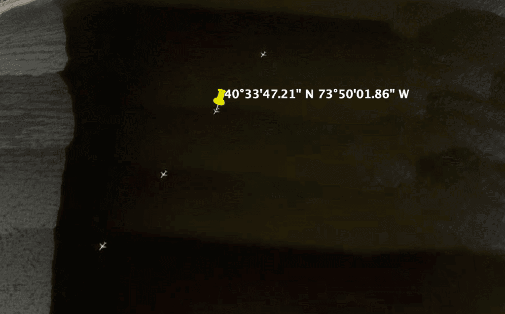
Let's look at why this happens, using the example of a plane that allegedly sank near New York (40.563114, -73.833850).
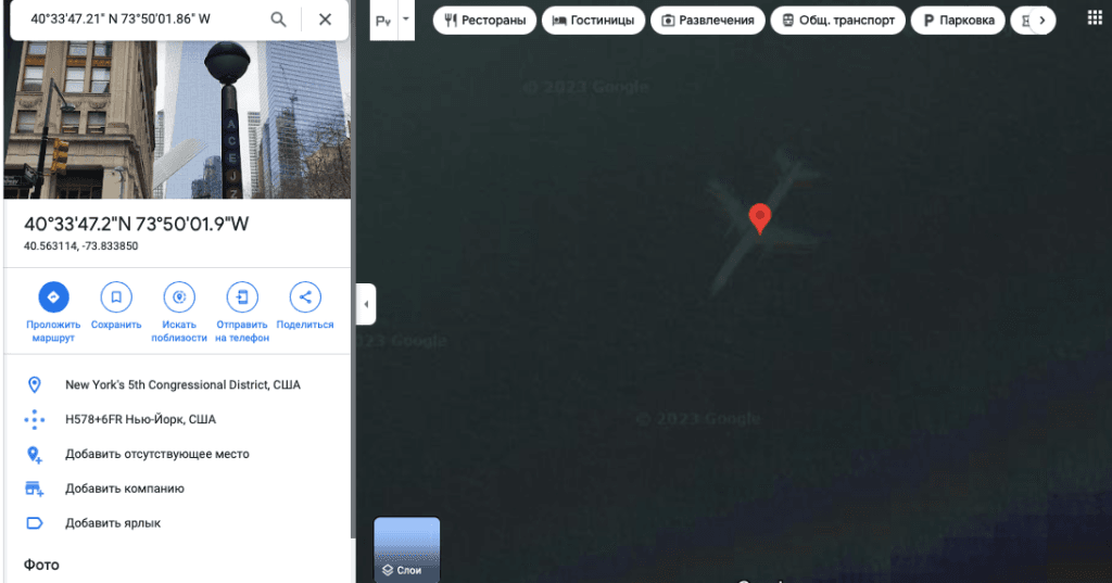
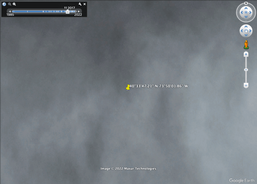
The plane is clearly visible on the map, but it is impossible to find out from which images the result was obtained in the web version of Google Earth. But in the application you can see each of the variations of the photo indicating the month and year. In the image from November 2017, it is cloudy, the surface of the water is not visible at all, the photo from 2018 was taken at night, but in the image from June 2019 we can see a plane flying by and track its movement. That is, the plane did not lie under water at all, but moved above its surface exactly at the moment when the satellite flew over it, and then safely reached its point of arrival.
However, in the modern web version of Google there is no Edinburgh liner. The satellite re-photographed this area in 2018; during the filming, not a single plane flew over the specified location. The function of viewing the same area in different years allows us to see that in 2016 there is no plane at the bottom, in 2017 it appears, and in the image from 2018 we again see a clear expanse of water.
As you can see in this example, Google Earth's technology actually combines multiple satellite images to create a composite image. And to users unfamiliar with the principle of operation of the system, it seems that the planes are under water. However, they did not crash, but only flew over the surface.
Cover image: New York Post

Misconception
If you find a spelling or grammatical error, please let us know by highlighting the error text and clicking Ctrl+Enter.