In April 2022, information appeared in the media that satellite images of strategic objects of the Russian Federation became available in maximum resolution for all users of the popular service. We checked if this is true.
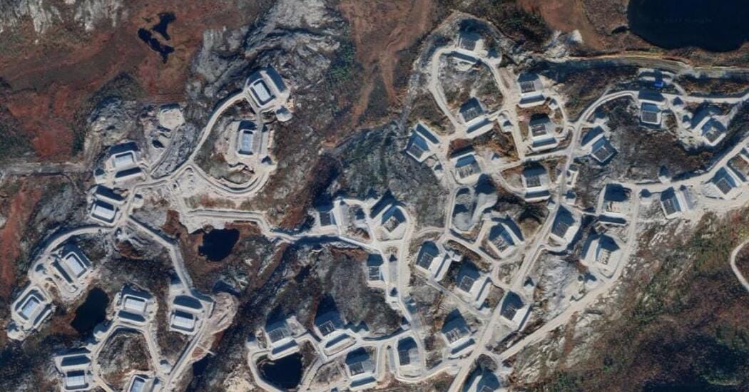
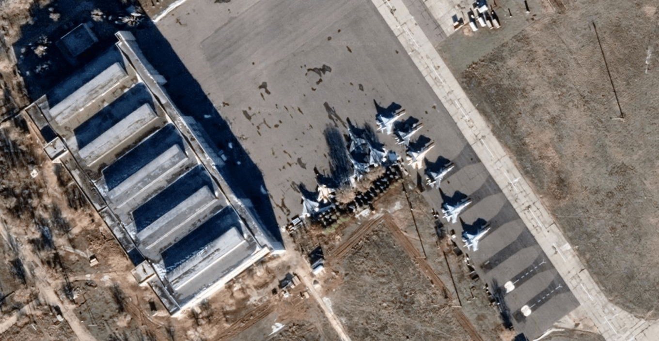
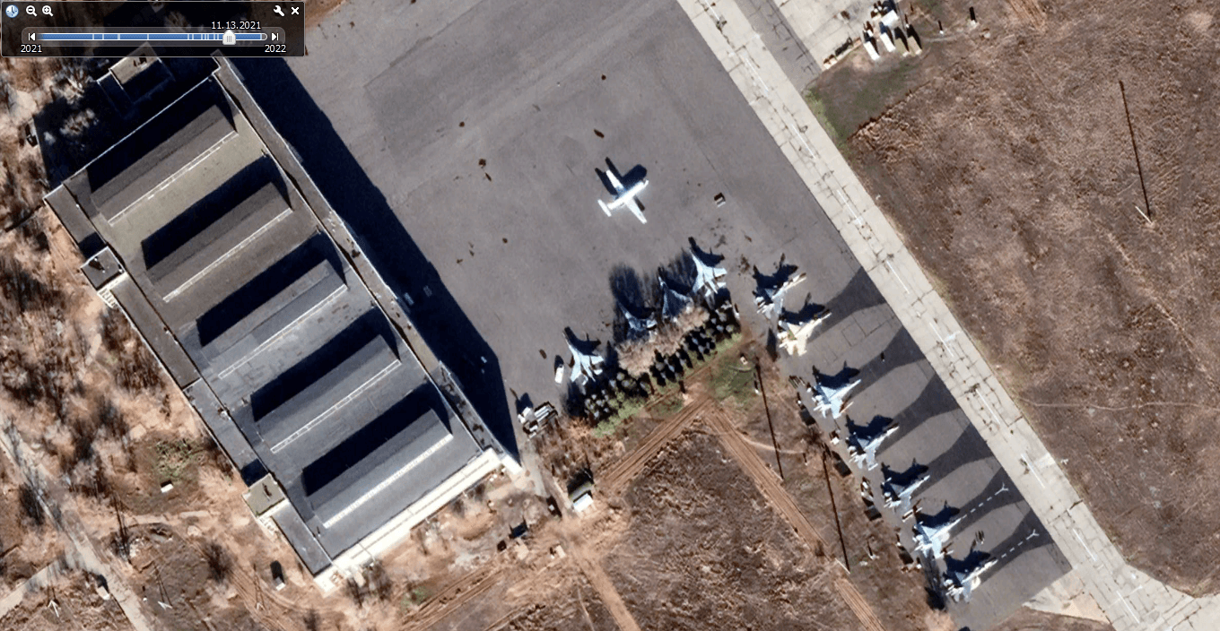
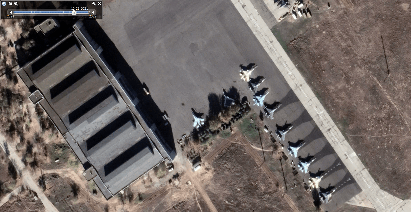
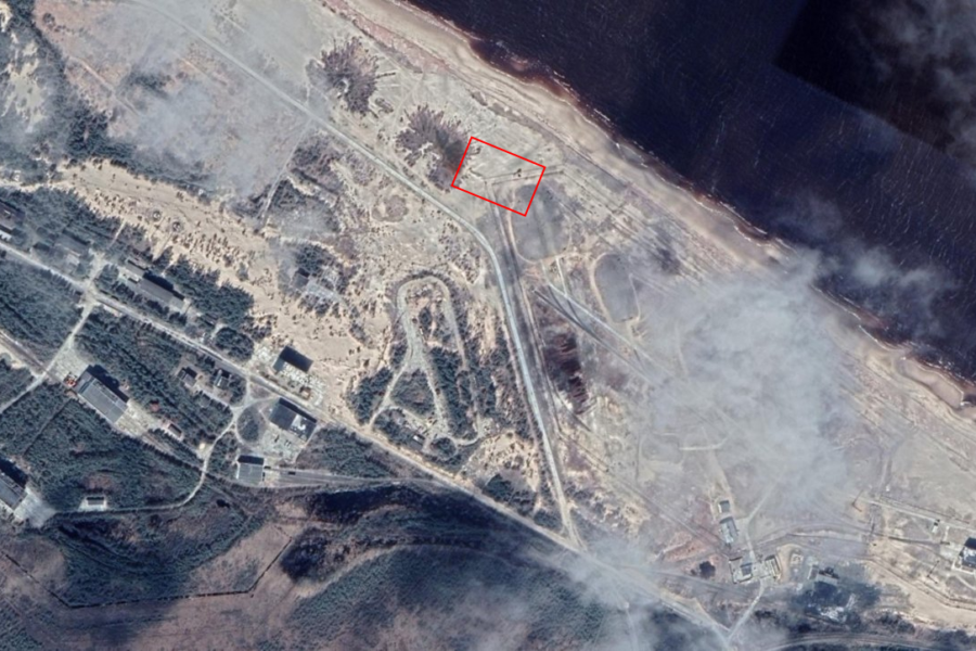
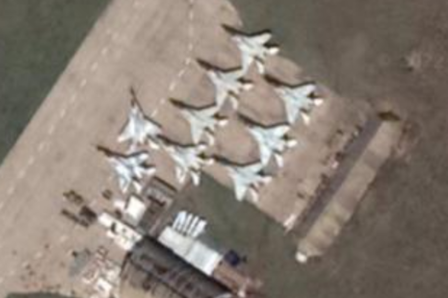
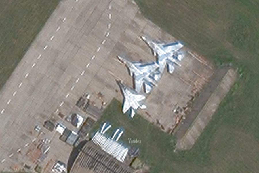
April 17, 2022 Ukrainian edition of Defense Express published material “Find Putin’s bunker: Google has opened high-quality satellite images of all strategic points of the Russian Federation.” The next day, news with similar headlines appeared in other Ukrainian publications (UNIAN, "Today", "Apostrophe", "Focus", "Ukrainian Truth", ZN.ua), and in Russian ("Ren-TV", "The Secret of the Company", DailyStorm, "Tsargrad"). The authors of these publications claim that previously there were certain restrictions on the publication of this kind of images (the reasons were not given), but now these restrictions have been lifted. Most articles and messages are illustrated with photographs of five objects: the aircraft-carrying cruiser Admiral Kuznetsov, a nuclear ammunition storage facility near Murmansk, a flight test site with the latest Su-57 fighters, a silo launcher and an air base near Kursk. Some articles also mention the infamous incident August 8, 2019 Nenoksa training ground, submarine base in Kamchatka, nuclear-powered missile cruiser "Peter the Great" and other objects.
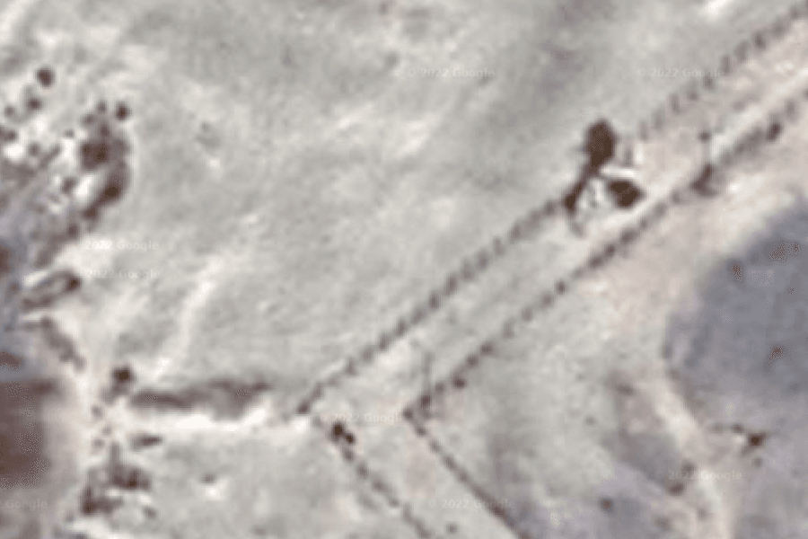
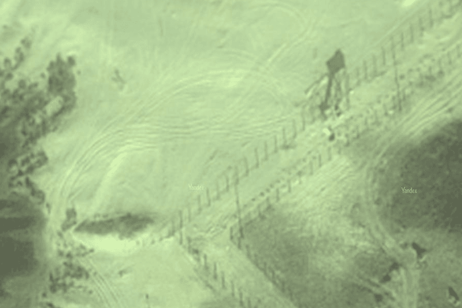
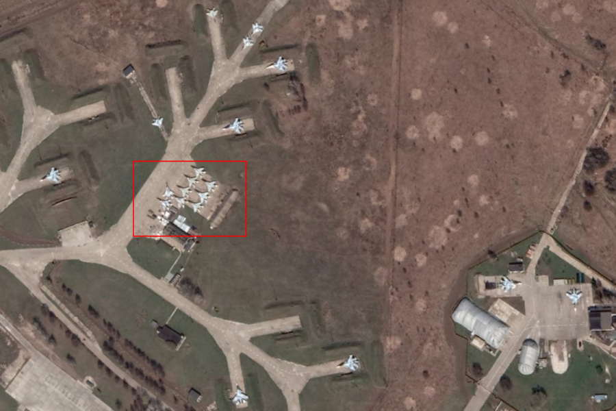
First of all, we tied most of the above-mentioned space images to the terrain. Then using the desktop version of the service Google Earth We were convinced that all the objects found were accurately photographed from space more than once. For example, the flight test site in the Astrakhan region (coordinates 48.3092275, 46.1871688) was photographed at least 13 times during 2021 (in the illustrations below this can be seen in the upper left corner, each image corresponds to a white line). Even if the most recent photo of this location was truly inaccessible or blurry until April. However, it is easy to verify that images adjacent in time are of no worse quality and no less informative.
Maybe Google has now published not only the latest, but also a whole bunch of old, equally detailed images? It's easy to check that this is not the case. Here, for example, article publication of The Barents Observer, from which it follows that in the fall of 2018, high-quality satellite images of the nuclear weapons storage facility were already in the public domain (in the screenshot from the Wikimapia service, which uses Google images, this storage facility is labeled as “Technical territory No. 4”).
The most interesting thing is revealed when directly comparing images of the same strategic objects of the Russian Federation on the Google Maps and Yandex.Maps services - it turned out that the images that are publicly available on the domestic platform are sometimes even better quality than those of their overseas colleagues!
April 19, verified Google Maps Twitter account replied when asked by one user regarding recent news: "Please keep in mind that we have not altered the blur in our satellite images of Russia in any way." Similar comment from a Google representative published and TASS agency. Strictly speaking, these words answer only the question of whether Google has now stopped blurring anything in images of Russian territory, but they do not answer whether something fundamentally new has been made publicly available. Nevertheless, based on the totality of the facts, our verdict is clear.

Not true
- Is it true that there is an island of floating debris visible from space in the Pacific Ocean?
- Is it true that a TikTok user discovered a field with hundreds of zombies on Google Earth?
If you find a spelling or grammatical error, please let us know by highlighting the error text and clicking Ctrl+Enter.