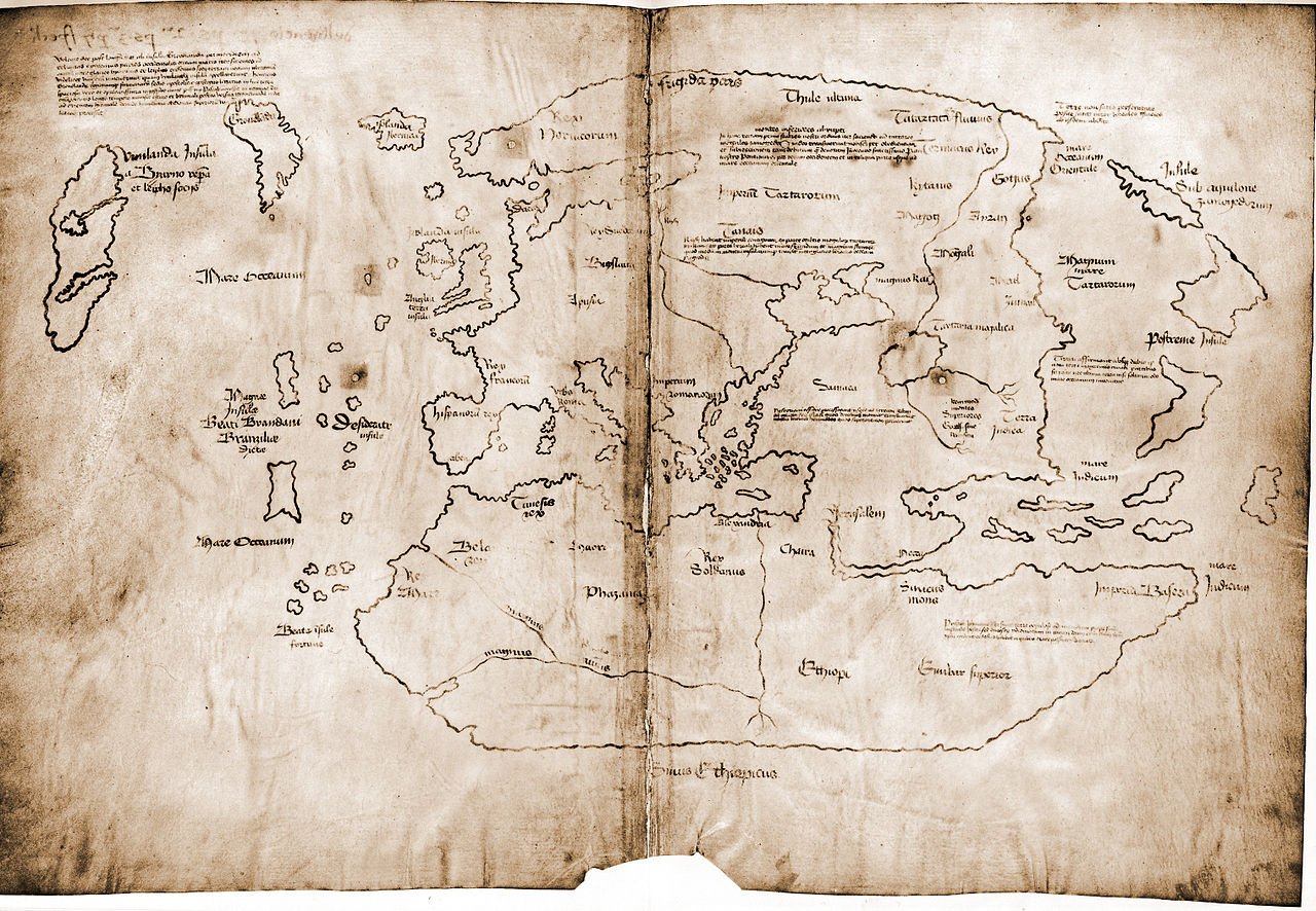
For several decades now, Yale University has kept a document supposedly from pre-Columbian times, which depicted the outlines of the American continent. Recently, researchers verified the authenticity of this card.
The Map of Vinland is a small manuscript dating back to the 15th century. Unlike other pre-Columbian maps, it shows not only Eurasia and Africa, but also the outlines of Greenland and North America. This document became known for the first time known in 1957, when the bookseller Irving Davis offered it first to the British Museum and then to the American Lawrence Witten. A few years later, it was acquired and donated to Yale University by Paul Mellon, and in 1965, potentially the oldest map with the outlines of the American continent was presented to the public.
Unique find quite quickly attracted attention from skeptics as well. The authenticity of the document has been questioned due to its incredible geographical accuracy for the time and other less significant details. In 1973, researchers in Chicago proved that the ink used to create the map contained anatase, a titanium compound that began to be used commercially only in the 1920s. In 2004, Danish scientists worked with the map, analyzed the properties of the parchment and also came to the conclusion that the document appeared relatively recently.
September 1, 2021 Yale University stated that its experts had completed the most detailed and lengthy examination of the Vinland map. The research team also focused on the ink used to create the document. Using X-ray fluorescence spectroscopy, they scanned the map and drew up a diagram of its elements. Experts say medieval scribes used iron-based ink. X-ray fluorescence analysis showed a negligible presence of this metal on the card, but titanium and a small amount of barium were found on the manuscript. This is another argument in support of the fact that when creating the document, ink no older than the 1920s was used - at that time, titanium-based inks also contained barium sulfate. This conclusion was also confirmed using electron microscopy - the anatase particles on the map are very similar to the pigment that began to be produced in Norway in 1923.
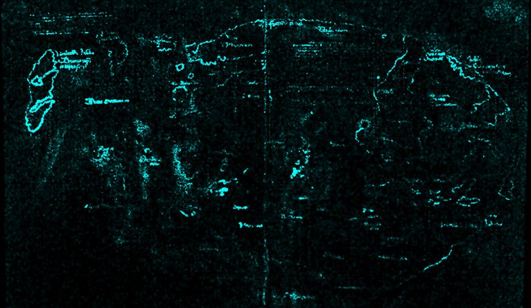
For comparison, the scientists examined ink in 50 handwritten texts from the Beinecke Library collection at Yale University. The researchers selected documents created at the same time as the Vinland map was said to have appeared. It turned out that the ink in these manuscripts contains much less titanium and much more iron.
The researchers promised to present the results of their work in scientific articles in the future. At the same time, they plan to leave the map of Vinland in the collection of the Beinecke Library. “It has already become a historical site. This is an excellent example of a forgery that had an international impact,” said Raymond Clemens, curator of the Yale Library.

Is it true
- Yale News. Analysis unlocks secret of the Vinland Map – it’s a fake
- K. Seaver. Maps, myths, and men: The story of the Vinland map
If you find a spelling or grammatical error, please let us know by highlighting the error text and clicking Ctrl+Enter.